


About Beaufort
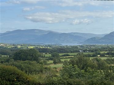
Beaufort is a scenic rural village and parish in County Kerry, west of Killarney and close to the River Laune, with mountain and countryside views towards the MacGillycuddy’s Reeks. It has a peaceful, community-oriented character, while Killorglin and Killarney provide larger centres for shopping, services, employment and entertainment. Day-to-day life suits people who value space, outdoor access and a quieter setting, although a car is generally important for commuting and errands. Local education includes primary-school provision in the surrounding parish, while Fossa School Sports Complex is a nearby recognised education and sports facility. Road connections are centred on the N72 and N70, linking Beaufort with Killorglin, Killarney, Glenbeigh and wider West Kerry; nearby rail services are available at Farranfore and Killarney, with buses serving the main regional roads. Residents can use local pubs and rural hospitality venues, while Killorglin and Killarney offer a broader choice of restaurants, cafés and supermarkets. Outdoor recreation is a major attraction, with access to the Laune valley, Caragh Lake, walking routes and the Killarney area’s parks and lakes. Parkavonear Castle, near Killarney, is a notable historic landmark, and local GAA, outdoor and community activities help give the wider area a strong social identity.
Property Market in Beaufort
Based on 4 properties for sale in Beaufort
Property types
Bedrooms
New listings covers the last 3 months; all other figures reflect properties currently for sale.
What’s in Beaufort
Schools
Education and sports complex serving children and families near Fossa and Killarney.
Local primary-school provision serving the Beaufort parish and surrounding rural communities.
Local post-primary school offering broad education and extracurricular opportunities in Killorglin.
Established secondary school providing post-primary education in the nearby town.
Transport
Plan your journey ↗Regional road linking Beaufort with Killorglin, Killarney and towns towards County Cork.
Scenic national route connecting nearby communities with Glenbeigh and West Kerry.
Mainline station with services towards Mallow, Cork, Tralee and Dublin connections.
Nearby station serving regional rail journeys between Kerry and national destinations.
Regional buses connect surrounding villages and towns, particularly along main roads.
Amenities
Historic medieval castle ruins near Killarney, set beside scenic lakeside countryside.
Picturesque lake offering fishing, walking, boating and expansive mountain scenery nearby.
Extensive national park with lakes, woodland, trails and celebrated Kerry landscapes.
Visit website ↗Nearby centre for supermarkets, cafés, pubs, restaurants, banking and everyday services.
Larger regional centre with extensive retail, hospitality, culture and visitor amenities.
Well-known traditional hospitality venue at the Gap of Dunloe entrance.
Visit website ↗Historic Killorglin inn offering food, drinks and accommodation in the town centre.
Local Clubs & Businesses
Local Gaelic games club supporting sporting participation and community activity.
Established nearby club with Gaelic football, hurling and community involvement.
Traditional local gathering place serving residents and visitors in the parish.
Popular local attraction with walking, traditional jaunting cars and mountain scenery.
Regional craft brewery and hospitality business associated with the Killarney area.



Nearby Areas
About this guide: This neighbourhood guide includes content generated with the assistance of artificial intelligence and images sourced from third-party platforms including Wikipedia. While we aim for accuracy, details such as local amenities, transport links, schools, and property data may change or contain errors. This content is provided for general informational purposes only and should not be relied upon as a substitute for independent verification. MyHome.ie accepts no liability for inaccuracies, omissions, or decisions made in reliance on this content.