Description
Show more...
| Beds | |
| Price | Sold |
| Property Type | |
| Size | meters2 |
| Energy Rating | BER- |
| Refreshed on | |
| Eircode |
Description
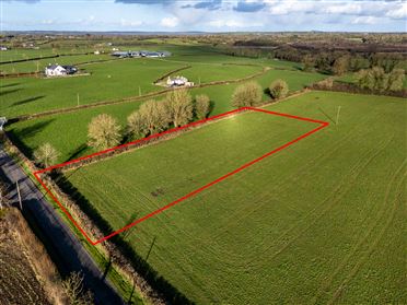
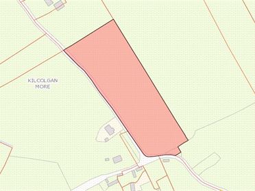
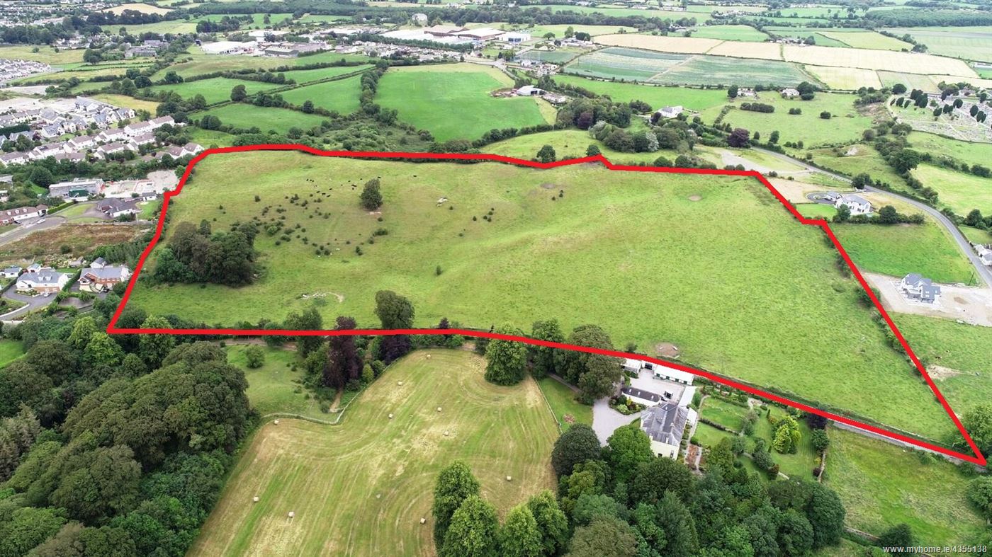
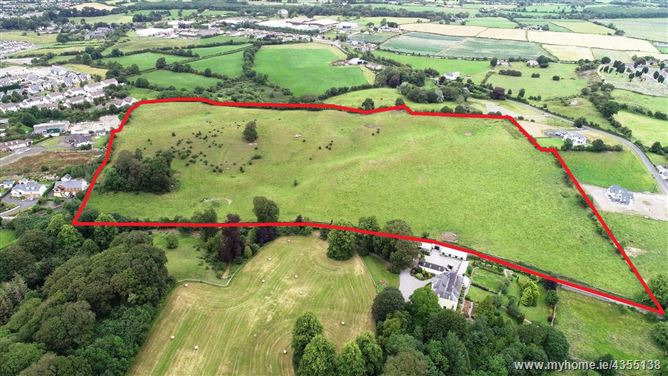
Development Lands of 9.15 hectares/22.60 acres. The subject lands are Zoned ‘Residential’ in the Birr & Environs Development Plan 2010-2016 (Extended to 2020). Located in a very desirable residential neighbourhood, adjacent to Birr Town Centre. LOCATION The lands are situated in a suburban location, with frontage onto a local road (Hillside), approx 0.75km from the N62 National Secondary Route & approx 1.75km to Birr Town Centre. The immediate area is mainly residential & agricultural in nature. Birr, with a population of 5,000, is situated in the Midlands of Ireland and is the largest town in South-West Offaly. The town provides “Key Services” to its rural hinterland and the western part of the Midlands Region. Birr is conveniently located between the M7 (Dublin-Limerick) motorway and the M6 (Dublin-Galway). The N52 (Dundalk - Nenagh) and N62 (Athlone - Roscrea) national secondary routes run through the town and provide direct access to Tullamore and Athlone respectively. There are excellent bus services to Dublin, Limerick, Tullamore & Athlone. DESCRIPTION The subject property (Folio OY2108F) consists of a plot of land of c. 9.15 hectares/22.60 acres, laid out in 1 division. The lands are elevated and are currently under grass. Road frontage extends to c. 400 metres. Boundaries consist of mainly stone walling & fencing. The subject lands are zoned ‘Residential’ in the Birr & Environs Development Plan 2010-2016 (Extended to 2020).
Date created: Jul 26, 2019