Description
Features
BER Details
Directions
Negotiator
Show more...


| Beds | |
| Price | €4,500,000 |
| Property Type | |
| Size | 0 meters2 |
| Energy Rating | BER- |
| Refreshed on | Apr 30, 2024 |
| Eircode |
Description
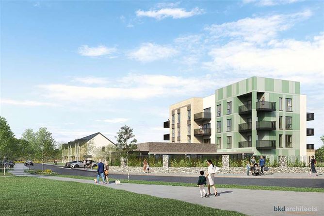
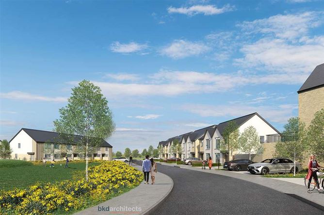
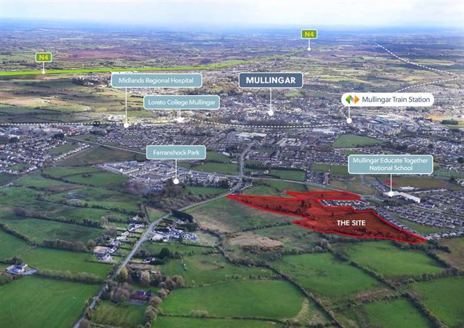
The subject site is irregular in shape and comprises a consolidated site off the roundabout on the R394. The lands are relatively flat, with defined boundaries made up of hedgerows and wooden fences. The entire landholding is approx. 6.37 Ha (15.7 acre). The site represents a “shovel-ready” development opportunity for a significant large residential development. The site is zoned ‘Proposed Residential’ under the with Mullingar Local Area Plan 2014-2020.
Features
Site extending to approximately 6.35 Ha (15.7 Ac) Well-located site close to Mullingar Town Excellent connectivity to the N4 and Public Transport FPP for 207 residential units under planning ref: ABP-13973-22
BER Details
Directions
The subject property is a greenfield site, located approximately 1.5km west of Mullingar town centre, at Rathgowan and within walking distance of Midlands Regional Hospital. The property is specifically located east of the R394, which is known as the Mullingar Western Relief Road. To the west and south of the application site is an existing the housing estate at Rathgowan Wood/ Rathgowan Park and Ardilaun Heights respectively. Vehicular access to the proposed development is via the internal access road within Rathgowan Park, which is directly connected to the R394. To the south, on the opposite side of the R394 is the Mullingar Educate Together National School, with a number of other primary and secondary schools within walking distance. Additional community facilities including religious and sport/recreational uses are also located within the immediate area.
Negotiator
Karl Lynch
Date created: Apr 30, 2024