Description
BER Details
Directions
Show more...


| Beds | |
| Price | Sold |
| Property Type | Farm Land |
| Size | meters2 |
| Energy Rating | BER-Exempt |
| Refreshed on | |
| Eircode | |
| Group Name | Colliers |
| Sales License Number | 001223 |
Description
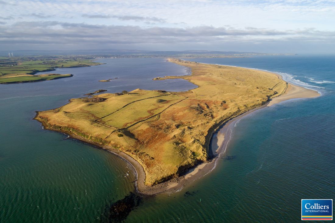
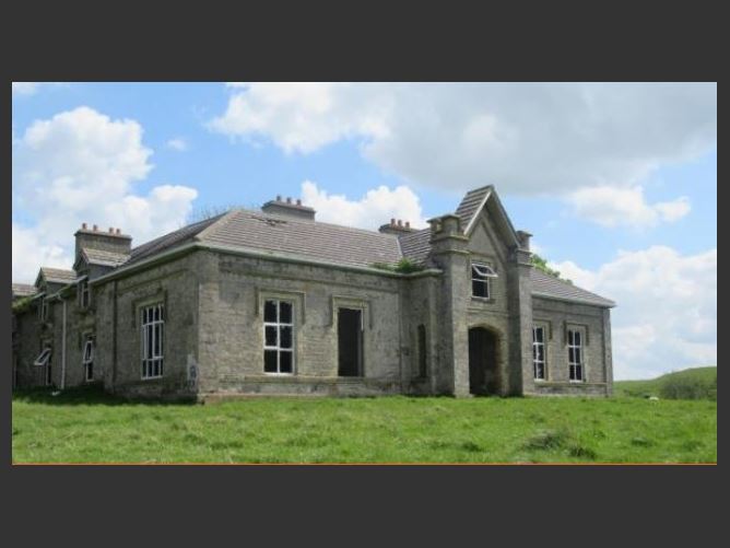
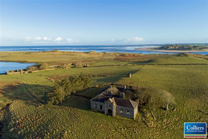
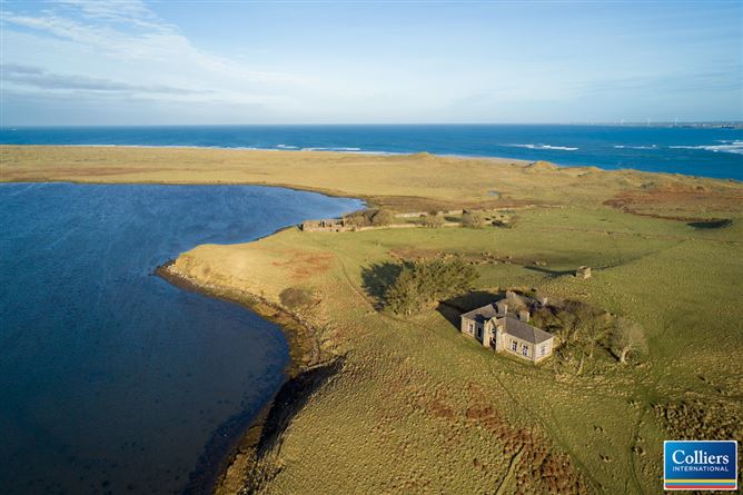
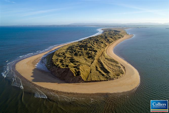
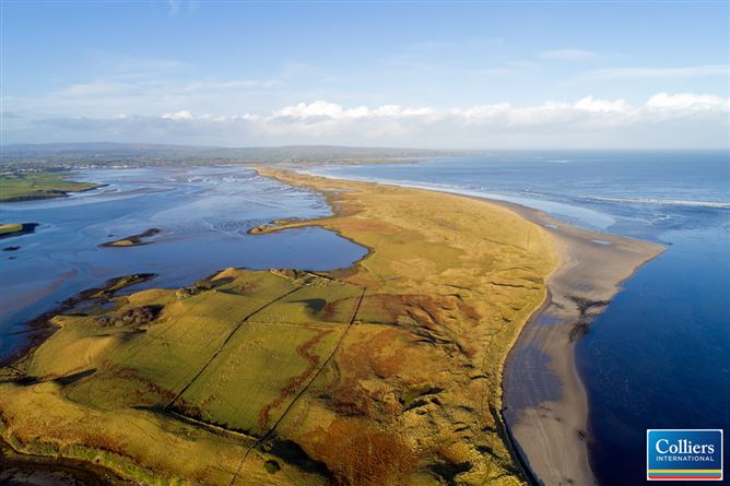
The property is an island extending to approximately 170 ha, estimating the boundary based on the Mean High-Water Mark. The island is approximately 4.6 km long and about 0.5 km wide at the widest point. The island reaches a maximum elevation of approximately 26m above mean sea level. The lands are of mixed quality with the majority being sand dune type vegetation and rough pasture. Towards the eastern end of the island is an area of grassland extending to approximately about 15ha. The pasture land and enclosures surround the derelict main residence. The house has a 5-bay front with half dormer attic, Georgian Gothic single bay breakfront with main entrance porch and window over, circa 1838. Some renovations included, replacement hipped slate roof with concrete ridge tiles, and paired chimney stacks on axis with ridge with terracotta pots. Masonry elevations, with rendered monoliths piers to corners cantered on rendered battlement piers. uPVC rainwater goods on limestone eaves. The interior of the house has seen some refurbishment work with the partial dry ling having been applied. The house has suffered from vandalism and the actions of the weather and thus in now in urgent need of repair. The house is registered in the National Inventory of Architectural Heritage at reference No 31302216.
BER Details
BER: Exempt
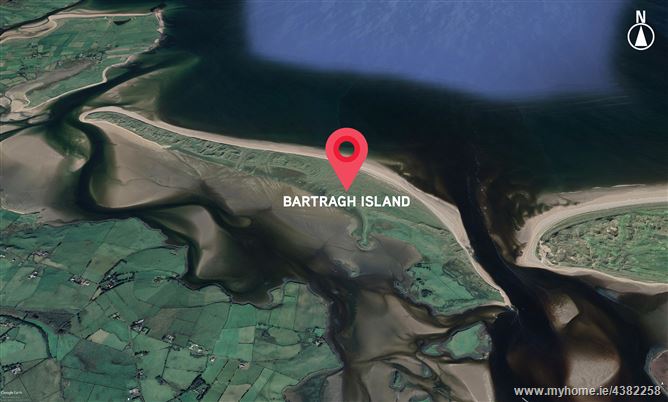
Directions
From Killala, by boat.
Date created: Nov 6, 2019